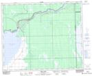
Maps showing Squaw Rapids Provincial Recreation Site, 54-9,10-W2, Saskatchewan
Squaw Rapids Provincial Recreation Site is a Conservation area located in 54-9,10-W2, Saskatchewan.
- Latitude: 53° 41' North (decimal: 53.6833806)
- Longitude: 103° 20' West (decimal: -103.3337846)
- Topography Feature Category: Conservation area
- Geographical Feature: Recreation Site
- Canadian Province/Territory: Saskatchewan
- Location: 54-9,10-W2
- GPS Coordinate Locator Map: Squaw Rapids Provincial Recreation Site Lat/Long
Squaw Rapids Provincial Recreation Site NTS Map Sheets