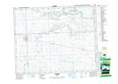
Maps showing Whitesand River Recreation Site, 24-29-4-W2, Saskatchewan
Whitesand River Recreation Site is a Conservation area located in 24-29-4-W2, Saskatchewan.
- Latitude: 51° 31' 46'' North (decimal: 51.5294979)
- Longitude: 102° 27' 13'' West (decimal: -102.4535586)
- Topography Feature Category: Conservation area
- Geographical Feature: Recreation Site
- Canadian Province/Territory: Saskatchewan
- Location: 24-29-4-W2
- Atlas of Canada Locator Map: Whitesand River Recreation Site
- GPS Coordinate Locator Map: Whitesand River Recreation Site Lat/Long