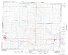
Maps showing Biggar and District Regional Park, 36-14-W3, Saskatchewan
Biggar and District Regional Park is a Conservation area located in 36-14-W3, Saskatchewan and has an elevation of 671 meters.
- Latitude: 52° 4' 45'' North (decimal: 52.0792191)
- Longitude: 107° 58' 32'' West (decimal: -107.9756710)
- Topography Feature Category: Conservation area
- Geographical Feature: Regional Park
- Canadian Province/Territory: Saskatchewan
- Elevation: 671 meters
- Location: 36-14-W3
- Atlas of Canada Locator Map: Biggar and District Regional Park
- GPS Coordinate Locator Map: Biggar and District Regional Park Lat/Long