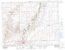
Maps showing Pine Cree Regional Park (Pine Cree Section), 2,3-8-21-W3, Saskatchewan
Pine Cree Regional Park (Pine Cree Section) is a Conservation area located in 2,3-8-21-W3, Saskatchewan and has an elevation of 1034 meters.
- Latitude: 49° 37' North (decimal: 49.6166911)
- Longitude: 108° 45' West (decimal: -108.7507144)
- Topography Feature Category: Conservation area
- Geographical Feature: Regional Park
- Canadian Province/Territory: Saskatchewan
- Elevation: 1034 meters
- Location: 2,3-8-21-W3
- Atlas of Canada Locator Map: Pine Cree Regional Park (Pine Cree Section)
- GPS Coordinate Locator Map: Pine Cree Regional Park (Pine Cree Section) Lat/Long
Pine Cree Regional Park (Pine Cree Section) NTS Map Sheets