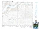
Maps showing Prairie Lake Regional Park, 19-20-10-W3, Saskatchewan
Prairie Lake Regional Park is a Conservation area located in 19-20-10-W3, Saskatchewan.
- Latitude: 50° 42' 45'' North (decimal: 50.7125340)
- Longitude: 107° 23' 2'' West (decimal: -107.3839895)
- Topography Feature Category: Conservation area
- Geographical Feature: Regional Park
- Canadian Province/Territory: Saskatchewan
- Location: 19-20-10-W3
- Atlas of Canada Locator Map: Prairie Lake Regional Park
- GPS Coordinate Locator Map: Prairie Lake Regional Park Lat/Long
Prairie Lake Regional Park NTS Map Sheets