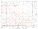
Maps showing Radville Laurier Regional Park, 6-18-W2, Saskatchewan
Radville Laurier Regional Park is a Conservation area located in 6-18-W2, Saskatchewan.
- Latitude: 49° 27' 35'' North (decimal: 49.4597540)
- Longitude: 104° 18' 2'' West (decimal: -104.3005346)
- Topography Feature Category: Conservation area
- Geographical Feature: Regional Park
- Canadian Province/Territory: Saskatchewan
- Location: 6-18-W2
- Atlas of Canada Locator Map: Radville Laurier Regional Park
- GPS Coordinate Locator Map: Radville Laurier Regional Park Lat/Long
Radville Laurier Regional Park NTS Map Sheets