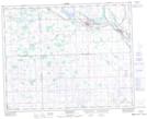
Maps showing Sturgis and District Regional Park (Site 1), 20-34-4-W2, Saskatchewan
Sturgis and District Regional Park (Site 1) is a Conservation area located in 20-34-4-W2, Saskatchewan and has an elevation of 497 meters.
- Latitude: 51° 56' North (decimal: 51.9333240)
- Longitude: 102° 32' West (decimal: -102.5338093)
- Topography Feature Category: Conservation area
- Geographical Feature: Regional Park
- Canadian Province/Territory: Saskatchewan
- Elevation: 497 meters
- Location: 20-34-4-W2
- Atlas of Canada Locator Map: Sturgis and District Regional Park (Site 1)
- GPS Coordinate Locator Map: Sturgis and District Regional Park (Site 1) Lat/Long
Sturgis and District Regional Park (Site 1) NTS Map Sheets