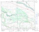
Maps showing Table Mountain Regional Park, Saskatchewan
Table Mountain Regional Park is a Conservation area located in Saskatchewan.
- Latitude: 52° 48' 30'' North (decimal: 52.8084023)
- Longitude: 108° 36' 33'' West (decimal: -108.6090308)
- Topography Feature Category: Conservation area
- Geographical Feature: Regional Park
- Canadian Province/Territory: Saskatchewan
- Atlas of Canada Locator Map: Table Mountain Regional Park
- GPS Coordinate Locator Map: Table Mountain Regional Park Lat/Long
Table Mountain Regional Park NTS Map Sheets