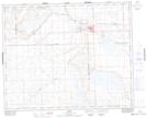
Maps showing Unity and District Regional Park, 14-40-23-W2, Saskatchewan
Unity and District Regional Park is a Conservation area located in 14-40-23-W2, Saskatchewan and has an elevation of 641 meters.
- Latitude: 52° 26' 30'' North (decimal: 52.4417363)
- Longitude: 109° 12' 33'' West (decimal: -109.2090660)
- Topography Feature Category: Conservation area
- Geographical Feature: Regional Park
- Canadian Province/Territory: Saskatchewan
- Elevation: 641 meters
- Location: 14-40-23-W2
- Atlas of Canada Locator Map: Unity and District Regional Park
- GPS Coordinate Locator Map: Unity and District Regional Park Lat/Long
Unity and District Regional Park NTS Map Sheets