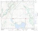
Maps showing Suffern Lake Regional Park (Manitou Section), 13,24,25-42,44-27-W3, Saskatchewan
Suffern Lake Regional Park (Manitou Section) is a Conservation area located in 13,24,25-42,44-27-W3, Saskatchewan and has an elevation of 610 meters.
- Latitude: 52° 48' North (decimal: 52.8000771)
- Longitude: 109° 47' West (decimal: -109.7840943)
- Topography Feature Category: Conservation area
- Geographical Feature: Regional Park
- Canadian Province/Territory: Saskatchewan
- Elevation: 610 meters
- Location: 13,24,25-42,44-27-W3
- Atlas of Canada Locator Map: Suffern Lake Regional Park (Manitou Section)
- GPS Coordinate Locator Map: Suffern Lake Regional Park (Manitou Section) Lat/Long
Suffern Lake Regional Park (Manitou Section) NTS Map Sheets