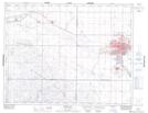
Maps showing Hill Crest, Saskatchewan
Hill Crest is a Unincorporated area located in Saskatchewan and has an elevation of 548 meters.
- Latitude: 50° 24' North (decimal: 50.4000263)
- Longitude: 105° 31' West (decimal: -105.5172396)
- Topography Feature Category: Unincorporated area
- Geographical Feature: Urban Community
- Canadian Province/Territory: Saskatchewan
- Elevation: 548 meters
- Atlas of Canada Locator Map: Hill Crest
- GPS Coordinate Locator Map: Hill Crest Lat/Long