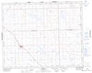
Maps showing Sparling's Coulee, Saskatchewan
Sparling's Coulee is a Valley located in Saskatchewan and has an elevation of 680 meters.
- Latitude: 52° 4' North (decimal: 52.0667305)
- Longitude: 109° 17' West (decimal: -109.2840806)
- Topography Feature Category: Valley
- Geographical Feature: Coulee
- Canadian Province/Territory: Saskatchewan
- Elevation: 680 meters
- Atlas of Canada Locator Map: Sparling's Coulee
- GPS Coordinate Locator Map: Sparling's Coulee Lat/Long
Sparling's Coulee NTS Map Sheets