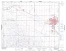
Maps showing Wellesley Park, Saskatchewan
Wellesley Park is a Unincorporated area located in Saskatchewan and has an elevation of 546 meters.
- Latitude: 50° 23' North (decimal: 50.3833599)
- Longitude: 105° 32' West (decimal: -105.5339072)
- Topography Feature Category: Unincorporated area
- Geographical Feature: Urban Community
- Canadian Province/Territory: Saskatchewan
- Elevation: 546 meters
- Atlas of Canada Locator Map: Wellesley Park
- GPS Coordinate Locator Map: Wellesley Park Lat/Long