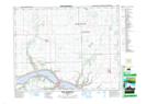
Maps showing Fort San, 18,24,26-21-13,14-W2, Saskatchewan
Fort San is a Village located in 18,24,26-21-13,14-W2, Saskatchewan and has an elevation of 503 meters.
- Latitude: 50° 48' 1'' North (decimal: 50.8002641)
- Longitude: 103° 49' 7'' West (decimal: -103.8185880)
- Topography Feature Category: Village
- Geographical Feature: Resort Village
- Canadian Province/Territory: Saskatchewan
- Elevation: 503 meters
- Location: 18,24,26-21-13,14-W2
- Atlas of Canada Locator Map: Fort San
- GPS Coordinate Locator Map: Fort San Lat/Long
Fort San NTS Map Sheets