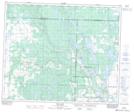
Maps showing Little Island Lake, 29,30,31,32-52-9-W3, Saskatchewan
Little Island Lake is a Lake located in 29,30,31,32-52-9-W3, Saskatchewan and has an elevation of 639 meters.
- Latitude: 53° 31' 35'' North (decimal: 53.5264467)
- Longitude: 107° 18' 12'' West (decimal: -107.3033749)
- Topography Feature Category: Lake
- Geographical Feature: Lake
- Canadian Province/Territory: Saskatchewan
- Elevation: 639 meters
- Location: 29,30,31,32-52-9-W3
- Atlas of Canada Locator Map: Little Island Lake
- GPS Coordinate Locator Map: Little Island Lake Lat/Long
Little Island Lake NTS Map Sheets