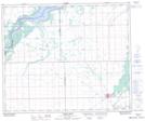
Maps showing Maurice Street Protected Area, 52-14-W2, Saskatchewan
Maurice Street Protected Area is a Conservation area located in 52-14-W2, Saskatchewan and has an elevation of 336 meters.
- Latitude: 53° 27' 40'' North (decimal: 53.4611555)
- Longitude: 103° 55' 42'' West (decimal: -103.9282313)
- Topography Feature Category: Conservation area
- Geographical Feature: Protected Area
- Canadian Province/Territory: Saskatchewan
- Elevation: 336 meters
- Location: 52-14-W2
- Atlas of Canada Locator Map: Maurice Street Protected Area
- GPS Coordinate Locator Map: Maurice Street Protected Area Lat/Long
Maurice Street Protected Area NTS Map Sheets