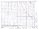
Maps showing Cooke Creek, 5-5-12-W2, Saskatchewan
Cooke Creek is a River located in 5-5-12-W2, Saskatchewan.
- Latitude: 49° 21' 35'' North (decimal: 49.3597505)
- Longitude: 103° 35' 14'' West (decimal: -103.5871733)
- Topography Feature Category: River
- Geographical Feature: Creek
- Canadian Province/Territory: Saskatchewan
- Location: 5-5-12-W2
- Atlas of Canada Locator Map: Cooke Creek
- GPS Coordinate Locator Map: Cooke Creek Lat/Long