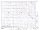
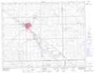
Maps showing Moseley Creek, 24-6-13-W2, Saskatchewan
Moseley Creek is a River located in 24-6-13-W2, Saskatchewan.
- Latitude: 49° 28' 54'' North (decimal: 49.4816925)
- Longitude: 103° 38' 2'' West (decimal: -103.6338528)
- Topography Feature Category: River
- Geographical Feature: Creek
- Canadian Province/Territory: Saskatchewan
- Location: 24-6-13-W2
- Atlas of Canada Locator Map: Moseley Creek
- GPS Coordinate Locator Map: Moseley Creek Lat/Long
Moseley Creek NTS Map Sheets