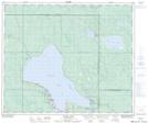
Maps showing Musker Pond, 3-56-23, Saskatchewan
Musker Pond is a Lake located in 3-56-23, Saskatchewan.
- Latitude: 53° 48' 20'' North (decimal: 53.8056052)
- Longitude: 105° 20' 57'' West (decimal: -105.3490801)
- Topography Feature Category: Lake
- Geographical Feature: Pond
- Canadian Province/Territory: Saskatchewan
- Location: 3-56-23
- Atlas of Canada Locator Map: Musker Pond
- GPS Coordinate Locator Map: Musker Pond Lat/Long
Musker Pond NTS Map Sheets