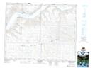
Maps showing Herbert Ferry Regional Park, 13-20-11-W3, Saskatchewan
Herbert Ferry Regional Park is a Conservation area located in 13-20-11-W3, Saskatchewan and has an elevation of 573 meters.
- Latitude: 50° 41' 25'' North (decimal: 50.6903116)
- Longitude: 107° 23' 11'' West (decimal: -107.3864893)
- Topography Feature Category: Conservation area
- Geographical Feature: Regional Park
- Canadian Province/Territory: Saskatchewan
- Elevation: 573 meters
- Location: 13-20-11-W3
- Atlas of Canada Locator Map: Herbert Ferry Regional Park
- GPS Coordinate Locator Map: Herbert Ferry Regional Park Lat/Long
Herbert Ferry Regional Park NTS Map Sheets