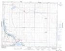
Maps showing Stoehr Creek, 31-27-8, Saskatchewan
Stoehr Creek is a River located in 31-27-8, Saskatchewan.
- Latitude: 51° 20' 38'' North (decimal: 51.3439260)
- Longitude: 106° 58' 22'' West (decimal: -106.9728589)
- Topography Feature Category: River
- Geographical Feature: Creek
- Canadian Province/Territory: Saskatchewan
- Location: 31-27-8
- Atlas of Canada Locator Map: Stoehr Creek
- GPS Coordinate Locator Map: Stoehr Creek Lat/Long