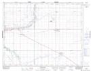
Maps showing Burdick Range, 3-17-25-W2, Saskatchewan
Burdick Range is a Military area located in 3-17-25-W2, Saskatchewan.
- Latitude: 50° 24' 25'' North (decimal: 50.4069715)
- Longitude: 105° 23' 0'' West (decimal: -105.3833459)
- Topography Feature Category: Military area
- Geographical Feature: C.F.T.A.
- Canadian Province/Territory: Saskatchewan
- Location: 3-17-25-W2
- Atlas of Canada Locator Map: Burdick Range
- GPS Coordinate Locator Map: Burdick Range Lat/Long