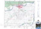
Maps showing Champ de tir Prince Albert, 27,28,33,34-48-26-W2; 34-49-26-W2, Saskatchewan
Champ de tir Prince Albert is a Military area located in 27,28,33,34-48-26-W2; 34-49-26-W2, Saskatchewan and has an elevation of 455 meters.
- Latitude: 53° 14' 15'' North (decimal: 53.2375410)
- Longitude: 105° 46' 1'' West (decimal: -105.7668958)
- Topography Feature Category: Military area
- Geographical Feature: C.M.F.C.
- Canadian Province/Territory: Saskatchewan
- Elevation: 455 meters
- Location: 27,28,33,34-48-26-W2; 34-49-26-W2
- Atlas of Canada Locator Map: Champ de tir Prince Albert
- GPS Coordinate Locator Map: Champ de tir Prince Albert Lat/Long
Champ de tir Prince Albert NTS Map Sheets