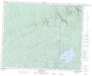
Maps showing Brockelbank Hill Protected Area, Saskatchewan
Brockelbank Hill Protected Area is a Conservation area located in Saskatchewan.
- Latitude: 52° 38' 18'' North (decimal: 52.6382364)
- Longitude: 101° 47' 15'' West (decimal: -101.7875551)
- Topography Feature Category: Conservation area
- Geographical Feature: Protected Area
- Canadian Province/Territory: Saskatchewan
- Atlas of Canada Locator Map: Brockelbank Hill Protected Area
- GPS Coordinate Locator Map: Brockelbank Hill Protected Area Lat/Long
Brockelbank Hill Protected Area NTS Map Sheets