Maps showing Nipekamew Sand Cliffs Protected Area, Saskatchewan
Nipekamew Sand Cliffs Protected Area is a Conservation area located in Saskatchewan.
- Latitude: 54° 43' 56'' North (decimal: 54.7323327)
- Longitude: 104° 59' 33'' West (decimal: -104.9924533)
- Topography Feature Category: Conservation area
- Geographical Feature: Protected Area
- Canadian Province/Territory: Saskatchewan
- Atlas of Canada Locator Map: Nipekamew Sand Cliffs Protected Area
- GPS Coordinate Locator Map: Nipekamew Sand Cliffs Protected Area Lat/Long
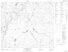
Nipekamew Sand Cliffs Protected Area NTS Map Sheets