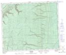
Maps showing Waskwei River Protected Area, Saskatchewan
Waskwei River Protected Area is a Conservation area located in Saskatchewan.
- Latitude: 53° 25' 13'' North (decimal: 53.4202201)
- Longitude: 102° 3' 9'' West (decimal: -102.0525732)
- Topography Feature Category: Conservation area
- Geographical Feature: Protected Area
- Canadian Province/Territory: Saskatchewan
- Atlas of Canada Locator Map: Waskwei River Protected Area
- GPS Coordinate Locator Map: Waskwei River Protected Area Lat/Long
Waskwei River Protected Area NTS Map Sheets