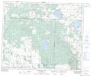
Maps showing Big Shell Lake Recreation Site, Saskatchewan
Big Shell Lake Recreation Site is a Conservation area located in Saskatchewan.
- Latitude: 53° 13' 5'' North (decimal: 53.2180054)
- Longitude: 107° 9' 0'' West (decimal: -107.1500722)
- Topography Feature Category: Conservation area
- Geographical Feature: Recreation Site
- Canadian Province/Territory: Saskatchewan
- Atlas of Canada Locator Map: Big Shell Lake Recreation Site
- GPS Coordinate Locator Map: Big Shell Lake Recreation Site Lat/Long
Big Shell Lake Recreation Site NTS Map Sheets