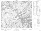
Maps showing Devil Lake Recreation Site, Saskatchewan
Devil Lake Recreation Site is a Conservation area located in Saskatchewan.
- Latitude: 55° 39' 23'' North (decimal: 55.6565105)
- Longitude: 104° 43' 57'' West (decimal: -104.7324312)
- Topography Feature Category: Conservation area
- Geographical Feature: Recreation Site
- Canadian Province/Territory: Saskatchewan
- Atlas of Canada Locator Map: Devil Lake Recreation Site
- GPS Coordinate Locator Map: Devil Lake Recreation Site Lat/Long
Devil Lake Recreation Site NTS Map Sheets