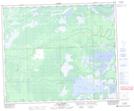
Maps showing Dragline Channel Recreation Site, Saskatchewan
Dragline Channel Recreation Site is a Conservation area located in Saskatchewan.
- Latitude: 53° 49' 59'' North (decimal: 53.8331641)
- Longitude: 102° 56' 37'' West (decimal: -102.9436673)
- Topography Feature Category: Conservation area
- Geographical Feature: Recreation Site
- Canadian Province/Territory: Saskatchewan
- Atlas of Canada Locator Map: Dragline Channel Recreation Site
- GPS Coordinate Locator Map: Dragline Channel Recreation Site Lat/Long
Dragline Channel Recreation Site NTS Map Sheets