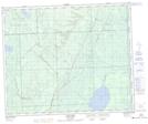
Maps showing Overflowing River Recreation Site, Saskatchewan
Overflowing River Recreation Site is a Conservation area located in Saskatchewan.
- Latitude: 53° 1' 59'' North (decimal: 53.0331543)
- Longitude: 102° 18' 54'' West (decimal: -102.3151357)
- Topography Feature Category: Conservation area
- Geographical Feature: Recreation Site
- Canadian Province/Territory: Saskatchewan
- Atlas of Canada Locator Map: Overflowing River Recreation Site
- GPS Coordinate Locator Map: Overflowing River Recreation Site Lat/Long
Overflowing River Recreation Site NTS Map Sheets