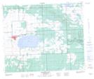
Maps showing Saint Cyr Hills Trails Recreation Site, Saskatchewan
Saint Cyr Hills Trails Recreation Site is a Conservation area located in Saskatchewan.
- Latitude: 54° 12' 16'' North (decimal: 54.2043876)
- Longitude: 108° 10' 11'' West (decimal: -108.1697862)
- Topography Feature Category: Conservation area
- Geographical Feature: Recreation Site
- Canadian Province/Territory: Saskatchewan
- Atlas of Canada Locator Map: Saint Cyr Hills Trails Recreation Site
- GPS Coordinate Locator Map: Saint Cyr Hills Trails Recreation Site Lat/Long
Saint Cyr Hills Trails Recreation Site NTS Map Sheets