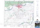
Maps showing Sturgeon River Recreation Site, Saskatchewan
Sturgeon River Recreation Site is a Conservation area located in Saskatchewan.
- Latitude: 53° 12' 43'' North (decimal: 53.2120080)
- Longitude: 105° 53' 8'' West (decimal: -105.8854290)
- Topography Feature Category: Conservation area
- Geographical Feature: Recreation Site
- Canadian Province/Territory: Saskatchewan
- Atlas of Canada Locator Map: Sturgeon River Recreation Site
- GPS Coordinate Locator Map: Sturgeon River Recreation Site Lat/Long
Sturgeon River Recreation Site NTS Map Sheets