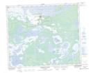
Maps showing Cumberland House Provincial Park, Saskatchewan
Cumberland House Provincial Park is a Conservation area located in Saskatchewan.
- Latitude: 53° 57' 35'' North (decimal: 53.9597736)
- Longitude: 102° 15' 51'' West (decimal: -102.2641146)
- Topography Feature Category: Conservation area
- Geographical Feature: Provincial Park
- Canadian Province/Territory: Saskatchewan
- Atlas of Canada Locator Map: Cumberland House Provincial Park
- GPS Coordinate Locator Map: Cumberland House Provincial Park Lat/Long
Cumberland House Provincial Park NTS Map Sheets