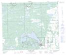
Maps showing Steele Narrows Provincial Park, Saskatchewan
Steele Narrows Provincial Park is a Conservation area located in Saskatchewan.
- Latitude: 54° 2' 26'' North (decimal: 54.0405643)
- Longitude: 109° 18' 34'' West (decimal: -109.3093146)
- Topography Feature Category: Conservation area
- Geographical Feature: Provincial Park
- Canadian Province/Territory: Saskatchewan
- Atlas of Canada Locator Map: Steele Narrows Provincial Park
- GPS Coordinate Locator Map: Steele Narrows Provincial Park Lat/Long
Steele Narrows Provincial Park NTS Map Sheets