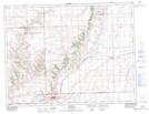
Maps showing Chimney Coulee Historic Site, Saskatchewan
Chimney Coulee Historic Site is a Conservation area located in Saskatchewan.
- Latitude: 49° 34' 20'' North (decimal: 49.5721118)
- Longitude: 108° 48' 24'' West (decimal: -108.8066454)
- Topography Feature Category: Conservation area
- Geographical Feature: Provincial Historic Site
- Canadian Province/Territory: Saskatchewan
- Atlas of Canada Locator Map: Chimney Coulee Historic Site
- GPS Coordinate Locator Map: Chimney Coulee Historic Site Lat/Long
Chimney Coulee Historic Site NTS Map Sheets