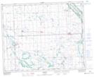
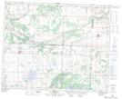
Maps showing Fort Pelly #1 Historic Site, Saskatchewan
Fort Pelly #1 Historic Site is a Conservation area located in Saskatchewan.
- Latitude: 51° 46' 42'' North (decimal: 51.7783817)
- Longitude: 102° 0' 19'' West (decimal: -102.0052528)
- Topography Feature Category: Conservation area
- Geographical Feature: Provincial Historic Site
- Canadian Province/Territory: Saskatchewan
- Atlas of Canada Locator Map: Fort Pelly #1 Historic Site
- GPS Coordinate Locator Map: Fort Pelly #1 Historic Site Lat/Long
Fort Pelly #1 Historic Site NTS Map Sheets