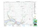
Maps showing Fort Qu'Appelle-Touchwood Hills Trail Historic Site, Saskatchewan
Fort Qu'Appelle-Touchwood Hills Trail Historic Site is a Conservation area located in Saskatchewan.
- Latitude: 50° 50' 46'' North (decimal: 50.8462497)
- Longitude: 103° 49' 53'' West (decimal: -103.8315224)
- Topography Feature Category: Conservation area
- Geographical Feature: Provincial Historic Site
- Canadian Province/Territory: Saskatchewan
- Atlas of Canada Locator Map: Fort Qu'Appelle-Touchwood Hills Trail Historic Site
- GPS Coordinate Locator Map: Fort Qu'Appelle-Touchwood Hills Trail Historic Site Lat/Long
Fort Qu'Appelle-Touchwood Hills Trail Historic Site NTS Map Sheets