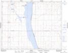
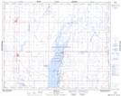
Maps showing Réserve nationale de faune de Stalwart, Saskatchewan
Réserve nationale de faune de Stalwart is a Conservation area located in Saskatchewan and has an elevation of 502 meters.
- Latitude: 51° 13' 30'' North (decimal: 51.2250364)
- Longitude: 105° 25' 2'' West (decimal: -105.4172458)
- Topography Feature Category: Conservation area
- Geographical Feature: Réserve nationale de faune
- Canadian Province/Territory: Saskatchewan
- Elevation: 502 meters
- Atlas of Canada Locator Map: Réserve nationale de faune de Stalwart
- GPS Coordinate Locator Map: Réserve nationale de faune de Stalwart Lat/Long
Réserve nationale de faune de Stalwart NTS Map Sheets