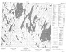
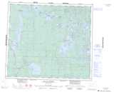
Maps showing Knee Lake 192B, 21-79-7-W3, Saskatchewan
Knee Lake 192B is a Indian Reserve located in 21-79-7-W3, Saskatchewan.
- Latitude: 55° 51' 59'' North (decimal: 55.8663646)
- Longitude: 107° 2' 7'' West (decimal: -107.0353998)
- Topography Feature Category: Indian Reserve
- Geographical Feature: Indian Reserve - Réserve indienne
- Canadian Province/Territory: Saskatchewan
- Location: 21-79-7-W3
- Atlas of Canada Locator Map: Knee Lake 192B
- GPS Coordinate Locator Map: Knee Lake 192B Lat/Long
Knee Lake 192B NTS Map Sheets