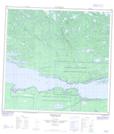
Maps showing Fond du Lac 228, 119,118-8,7-W3, Saskatchewan
Fond du Lac 228 is a Indian Reserve located in 119,118-8,7-W3, Saskatchewan.
- Latitude: 59° 18' 00'' North (decimal: 59.2999530)
- Longitude: 107° 12' 23'' West (decimal: -107.2063407)
- Topography Feature Category: Indian Reserve
- Geographical Feature: Indian Reserve - Réserve indienne
- Canadian Province/Territory: Saskatchewan
- Location: 119,118-8,7-W3
- Atlas of Canada Locator Map: Fond du Lac 228
- GPS Coordinate Locator Map: Fond du Lac 228 Lat/Long
Fond du Lac 228 NTS Map Sheets