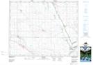
Maps showing Last Mountain Lake 80A, 16,17,18-21, 22-W2, Saskatchewan
Last Mountain Lake 80A is a Indian Reserve located in 16,17,18-21, 22-W2, Saskatchewan.
- Latitude: 50° 47' 13'' North (decimal: 50.7869981)
- Longitude: 105° 1' 40'' West (decimal: -105.0278561)
- Topography Feature Category: Indian Reserve
- Geographical Feature: Indian Reserve - Réserve indienne
- Canadian Province/Territory: Saskatchewan
- Location: 16,17,18-21, 22-W2
- Atlas of Canada Locator Map: Last Mountain Lake 80A
- GPS Coordinate Locator Map: Last Mountain Lake 80A Lat/Long