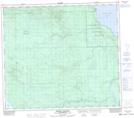
Maps showing Peter Pond Lake 193, 16,17-79,80-19,20-W3, Saskatchewan
Peter Pond Lake 193 is a Indian Reserve located in 16,17-79,80-19,20-W3, Saskatchewan.
- Latitude: 55° 56' 25'' North (decimal: 55.9403659)
- Longitude: 109° 1' 8'' West (decimal: -109.0187988)
- Topography Feature Category: Indian Reserve
- Geographical Feature: Indian Reserve - Réserve indienne
- Canadian Province/Territory: Saskatchewan
- Location: 16,17-79,80-19,20-W3
- Atlas of Canada Locator Map: Peter Pond Lake 193
- GPS Coordinate Locator Map: Peter Pond Lake 193 Lat/Long
Peter Pond Lake 193 NTS Map Sheets