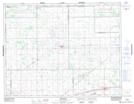
Maps showing Piapot 75, 20,21-18-W2, Saskatchewan
Piapot 75 is a Indian Reserve located in 20,21-18-W2, Saskatchewan.
- Latitude: 50° 33' 54'' North (decimal: 50.5649794)
- Longitude: 104° 28' 58'' West (decimal: -104.4827320)
- Topography Feature Category: Indian Reserve
- Geographical Feature: Indian Reserve - Réserve indienne
- Canadian Province/Territory: Saskatchewan
- Location: 20,21-18-W2
- Atlas of Canada Locator Map: Piapot 75
- GPS Coordinate Locator Map: Piapot 75 Lat/Long