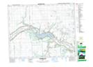
Maps showing Sakimay 74, 20,21-18,19-6-W2, Saskatchewan
Sakimay 74 is a Indian Reserve located in 20,21-18,19-6-W2, Saskatchewan.
- Latitude: 50° 33' 28'' North (decimal: 50.5577118)
- Longitude: 102° 47' 49'' West (decimal: -102.7970621)
- Topography Feature Category: Indian Reserve
- Geographical Feature: Indian Reserve - Réserve indienne
- Canadian Province/Territory: Saskatchewan
- Location: 20,21-18,19-6-W2
- Atlas of Canada Locator Map: Sakimay 74
- GPS Coordinate Locator Map: Sakimay 74 Lat/Long
Sakimay 74 NTS Map Sheets