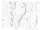
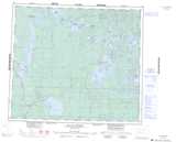
Maps showing La Plonge 192, 71,72,73-11-W3, Saskatchewan
La Plonge 192 is a Indian Reserve located in 71,72,73-11-W3, Saskatchewan.
- Latitude: 55° 12' 34'' North (decimal: 55.2094977)
- Longitude: 107° 35' 23'' West (decimal: -107.5897319)
- Topography Feature Category: Indian Reserve
- Geographical Feature: Indian Reserve - Réserve indienne
- Canadian Province/Territory: Saskatchewan
- Location: 71,72,73-11-W3
- Atlas of Canada Locator Map: La Plonge 192
- GPS Coordinate Locator Map: La Plonge 192 Lat/Long
La Plonge 192 NTS Map Sheets