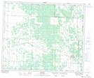
Maps showing Big River 118A, 1-52-7,8-W3, Saskatchewan
Big River 118A is a Indian Reserve located in 1-52-7,8-W3, Saskatchewan.
- Latitude: 53° 27' 49'' North (decimal: 53.4636732)
- Longitude: 107° 2' 51'' West (decimal: -107.0475929)
- Topography Feature Category: Indian Reserve
- Geographical Feature: Indian Reserve - Réserve indienne
- Canadian Province/Territory: Saskatchewan
- Location: 1-52-7,8-W3
- Atlas of Canada Locator Map: Big River 118A
- GPS Coordinate Locator Map: Big River 118A Lat/Long