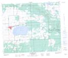
Maps showing Eagles Lake 165C, 21,22,27,28-59-14,15-W3, Saskatchewan
Eagles Lake 165C is a Indian Reserve located in 21,22,27,28-59-14,15-W3, Saskatchewan.
- Latitude: 54° 6' 20'' North (decimal: 54.1054775)
- Longitude: 108° 3' 26'' West (decimal: -108.0571800)
- Topography Feature Category: Indian Reserve
- Geographical Feature: Indian Reserve - Réserve indienne
- Canadian Province/Territory: Saskatchewan
- Location: 21,22,27,28-59-14,15-W3
- Atlas of Canada Locator Map: Eagles Lake 165C
- GPS Coordinate Locator Map: Eagles Lake 165C Lat/Long
Eagles Lake 165C NTS Map Sheets