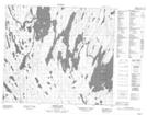
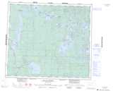
Maps showing Primeau Lake 192F, 79,80-8,9-W3, Saskatchewan
Primeau Lake 192F is a Indian Reserve located in 79,80-8,9-W3, Saskatchewan.
- Latitude: 55° 53' 25'' North (decimal: 55.8901785)
- Longitude: 107° 14' 59'' West (decimal: -107.2497543)
- Topography Feature Category: Indian Reserve
- Geographical Feature: Indian Reserve - Réserve indienne
- Canadian Province/Territory: Saskatchewan
- Location: 79,80-8,9-W3
- Atlas of Canada Locator Map: Primeau Lake 192F
- GPS Coordinate Locator Map: Primeau Lake 192F Lat/Long
Primeau Lake 192F NTS Map Sheets