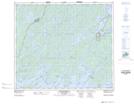
Maps showing Old Fort 157B, 72-17-W2, Saskatchewan
Old Fort 157B is a Indian Reserve located in 72-17-W2, Saskatchewan.
- Latitude: 55° 16' 53'' North (decimal: 55.2814582)
- Longitude: 104° 36' 21'' West (decimal: -104.6058550)
- Topography Feature Category: Indian Reserve
- Geographical Feature: Indian Reserve - Réserve indienne
- Canadian Province/Territory: Saskatchewan
- Location: 72-17-W2
- Atlas of Canada Locator Map: Old Fort 157B
- GPS Coordinate Locator Map: Old Fort 157B Lat/Long
Old Fort 157B NTS Map Sheets