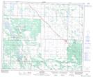
Maps showing Ahtahkakoop 104, 50,51-6,7-W3, Saskatchewan
Ahtahkakoop 104 is a Indian Reserve located in 50,51-6,7-W3, Saskatchewan.
- Latitude: 53° 23' 8'' North (decimal: 53.3855688)
- Longitude: 106° 54' 4'' West (decimal: -106.9011993)
- Topography Feature Category: Indian Reserve
- Geographical Feature: Indian Reserve - Réserve indienne
- Canadian Province/Territory: Saskatchewan
- Location: 50,51-6,7-W3
- Atlas of Canada Locator Map: Ahtahkakoop 104
- GPS Coordinate Locator Map: Ahtahkakoop 104 Lat/Long